
Cold Water Lines: A Surfer's Map of Norway
From the quiet reefs of Sørlandet to Unstad's Arctic point break above the polar circle — a region-by-region, source-checked map of Norway's surf coast.
Den här artikeln finns än så länge bara på engelska.
Intro
Norway has one of the longest, wildest coastlines in Europe, and almost none of it has been mapped for surfing the way Portugal or France has. What exists instead is a handful of tightly-documented hubs — a beginner beach near Stavanger, a storm-battered peninsula in the fjords, a bay above the Arctic Circle that's become a minor pilgrimage site — separated by hundreds of kilometres of coast nobody's written up. This is a companion piece to our map of Sweden and Denmark: same approach, same rule — every spot below is backed by at least one independent source, and every gap in the map is named as a gap rather than papered over with a guess.
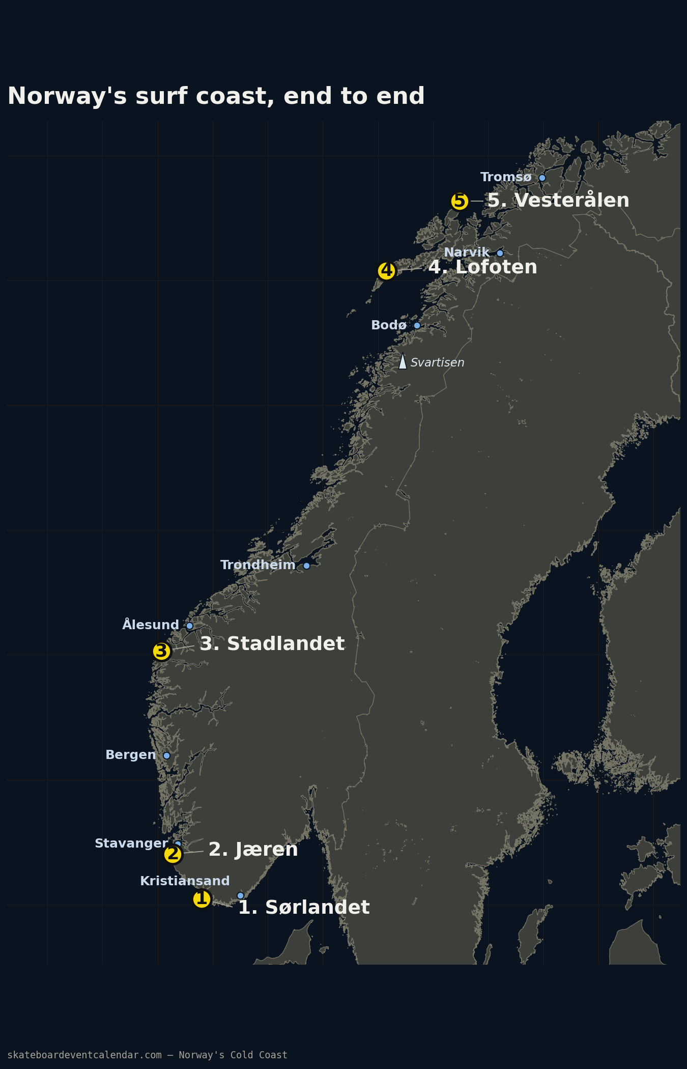
Before the region-by-region detail, here's the whole coast at once — where each of the five sections below actually sits, end to end from the Skagerrak to the Arctic:
Live conditions
Open full screenA live forecast widget for the Norwegian west coast (MET Norway Open Data, no API key), covering several of the spots above — including Unstad and Hoddevik — plus Eggum, Orrestranda, Borestranden, Åkrasanden, Solastranden and Raet.
Forecast by Bølgeagenten, an independent project — not affiliated with any spot's local surf club.
I. Sørlandet — the quiet south
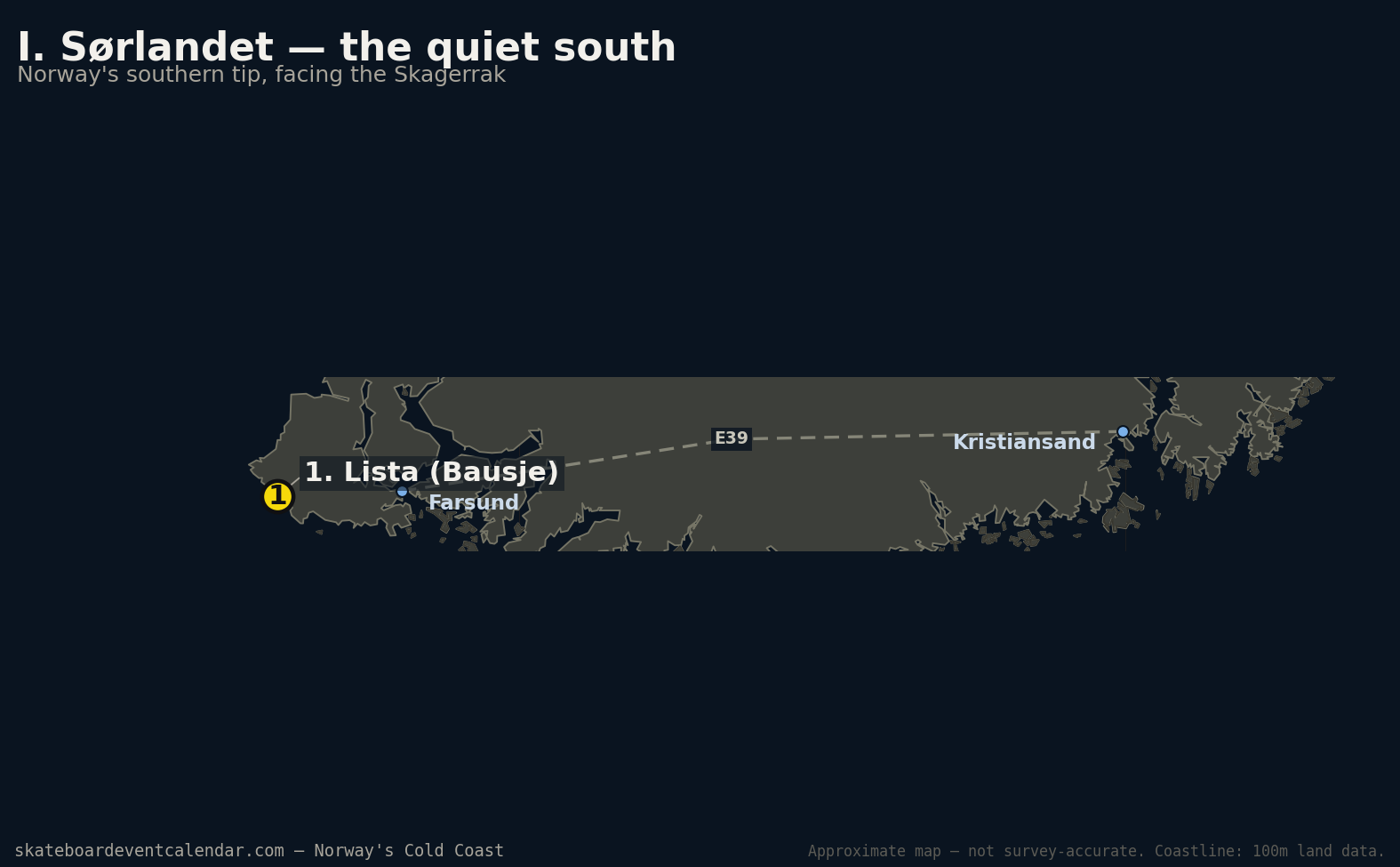
Norway's south coast faces the Skagerrak rather than the open North Sea or Atlantic, and it shows: this is the thinnest-documented stretch in this whole map. The Oslofjord itself has no documented wave-surfing spot at all as far as we could find — what turns up under "surfing" there is wake-surfing behind a boat, a different sport entirely. Further west, past Kristiansand, the coast opens up a little.
Lista (Bausje) — 58.09, 6.60 (confirmed). A reef break at Norway's southwestern tip, exposed enough to hold surf year-round. Best with a west swell and a north-northeast (offshore) wind. Rated fairly consistent but modest in size — this is a spot for filling in a flat day elsewhere, not a primary destination.
II. Jæren — Norway's surf capital
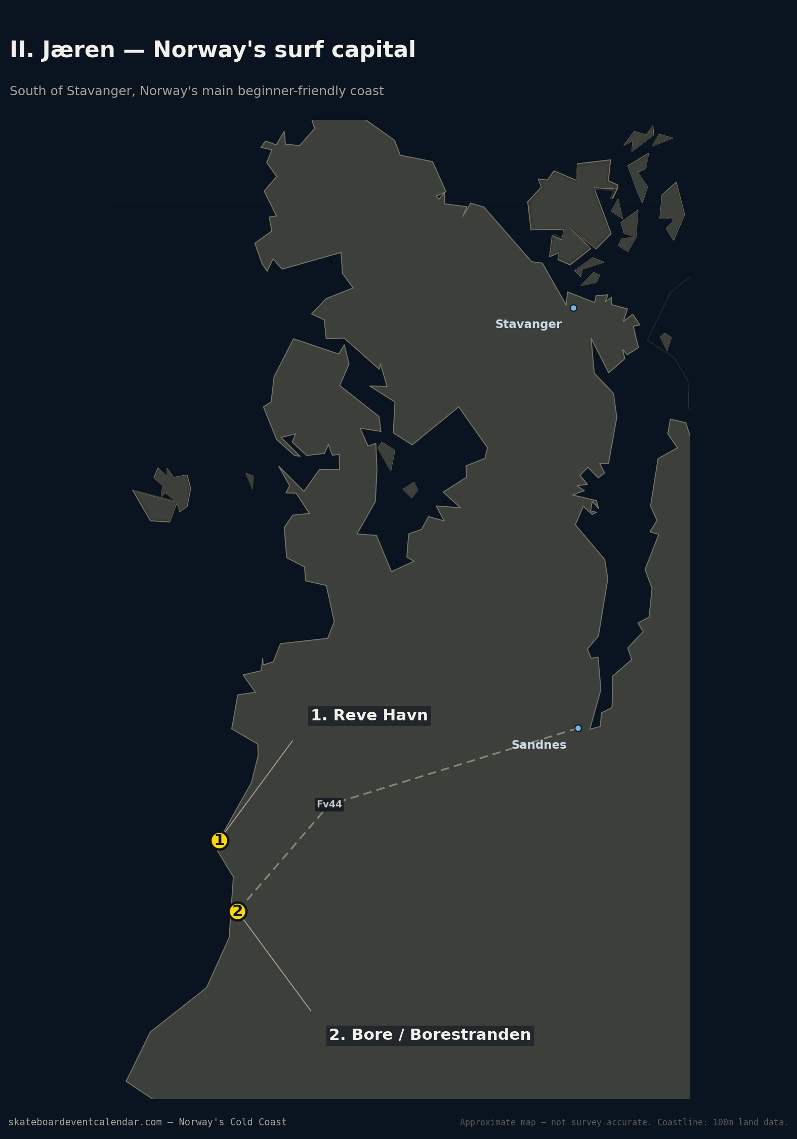
South of Stavanger, the coast straightens into a long run of dune-backed, honey-sand beaches — the closest thing Norway has to a proper beginner surf region, and the one place in the country with an established local surf school and rental scene (Boretunet, at Borestranden).
Reve Havn — 58.82, 5.54 (confirmed). A beach and reef setup with both left and right options. Best with a west swell and an east-southeast (offshore) wind; winter, especially January, is the most reliably clean stretch.
Bore / Borestranden — 58.80, 5.55 (confirmed). The region's main beach break and the site of the local surf school. Prevailing lefts, works at all tide stages, best with a west swell and an offshore wind from the east.
III. Stadlandet — the storm coast
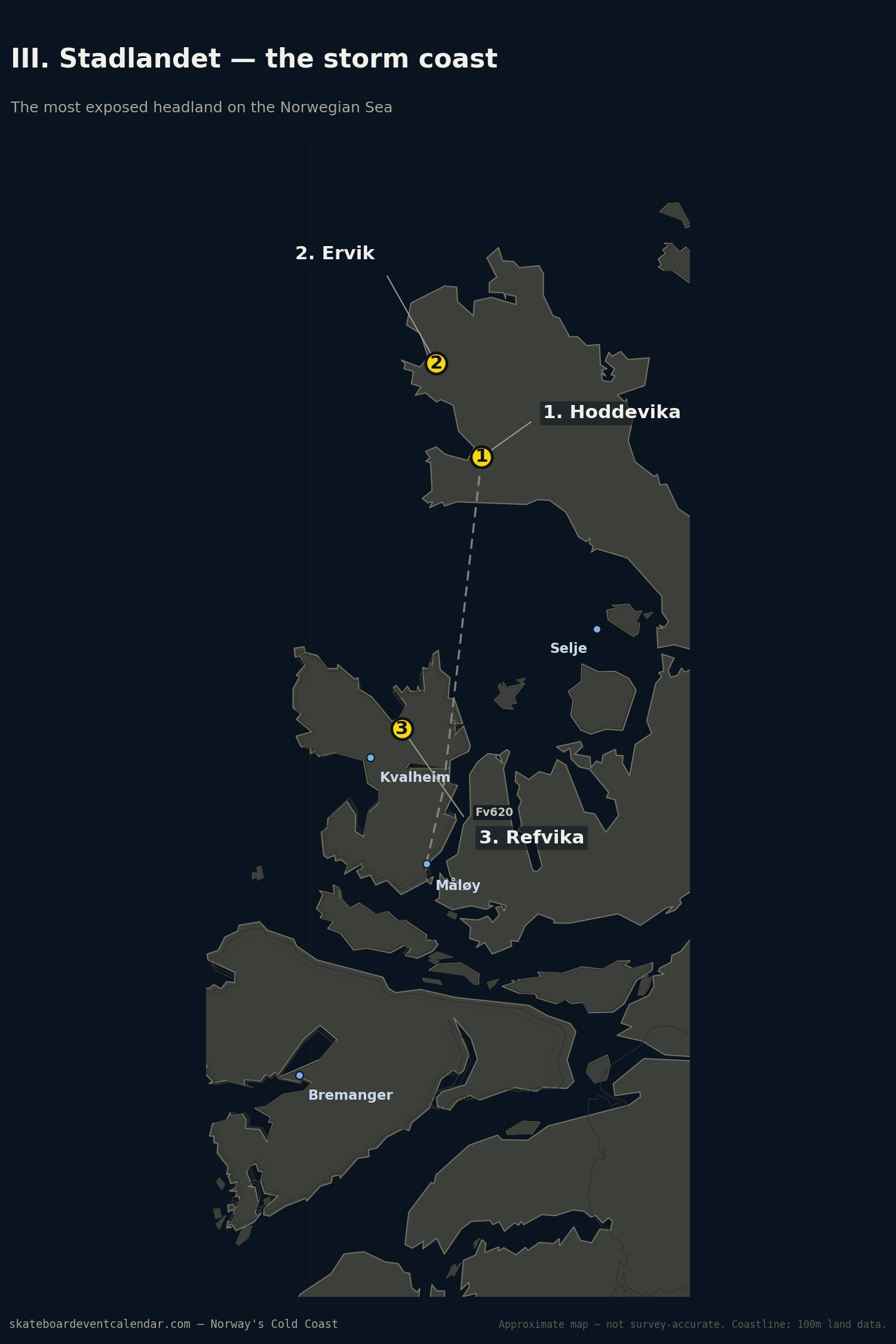
The Stad peninsula sits fully exposed to the open Norwegian Sea — no islands or skerries breaking the swell — and is consequently the most storm-battered stretch of coast in this whole guide. It's also home to Hoddevik, the closest thing Norway has to an internationally known wave.
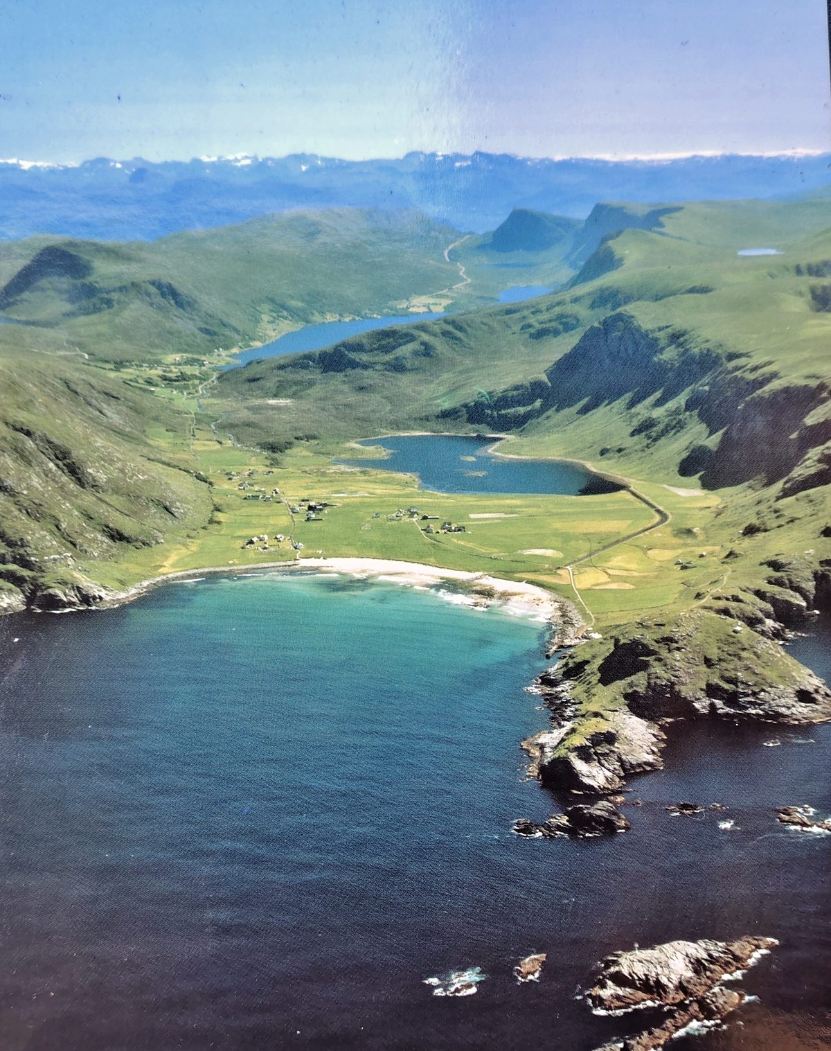 Ervik, Stadlandet — the exposed, mountain-framed coastline that makes this stretch both scenic and unforgiving.
Hoddevika — 62.1231, 5.1677 (confirmed). Cliffs over 100 metres tall frame a beach break that's mainly a left, sheltered a little from north winds, so a southeast wind is the call. Very consistent by Norwegian standards, and works at every stage of the tide. There's a dedicated surf camp (Stad Surfing) running lessons and glamping right at the beach.
Ervik — 62.1660, 5.1234 (approx — pin marks the village centre, not the beach itself). A separate bay a few kilometres northwest of Hoddevik, also called Ervikstranda, that picks up both southwest and northwest swell — a reliable back-up when Hoddevik itself isn't working. It's a right-and-left point/beach break over sand and rock, generally sloppier and more beginner-friendly than Hoddevika, and tends to run bigger. An old boat wreck in the bay helps shape the wave but has sharp metal exposed on its left side, so it's worth giving a wide berth. Ervik Surfshop, cited below, runs out of the village here.
Refvika — 61.9984, 5.0899 (confirmed). A quieter beach roughly 15km south of Hoddevik, near the village of Kvalheim, known locally for its pale, fine sand. Less written about as a surf spot specifically than Hoddevik, but it's the same exposed stretch of coast and worth checking when Hoddevik is overcrowded or blown out.
IV. Lofoten — the Arctic wave
This is the one every surf publication eventually writes about: a horseshoe bay above the Arctic Circle, framed by snow-capped peaks, that catches enough groundswell off the open Norwegian Sea to be called — by more than one source — the best performance wave in the country. It draws intermediate-to-advanced surfers specifically for that combination: real, well-shaped waves and genuinely dramatic scenery, together.
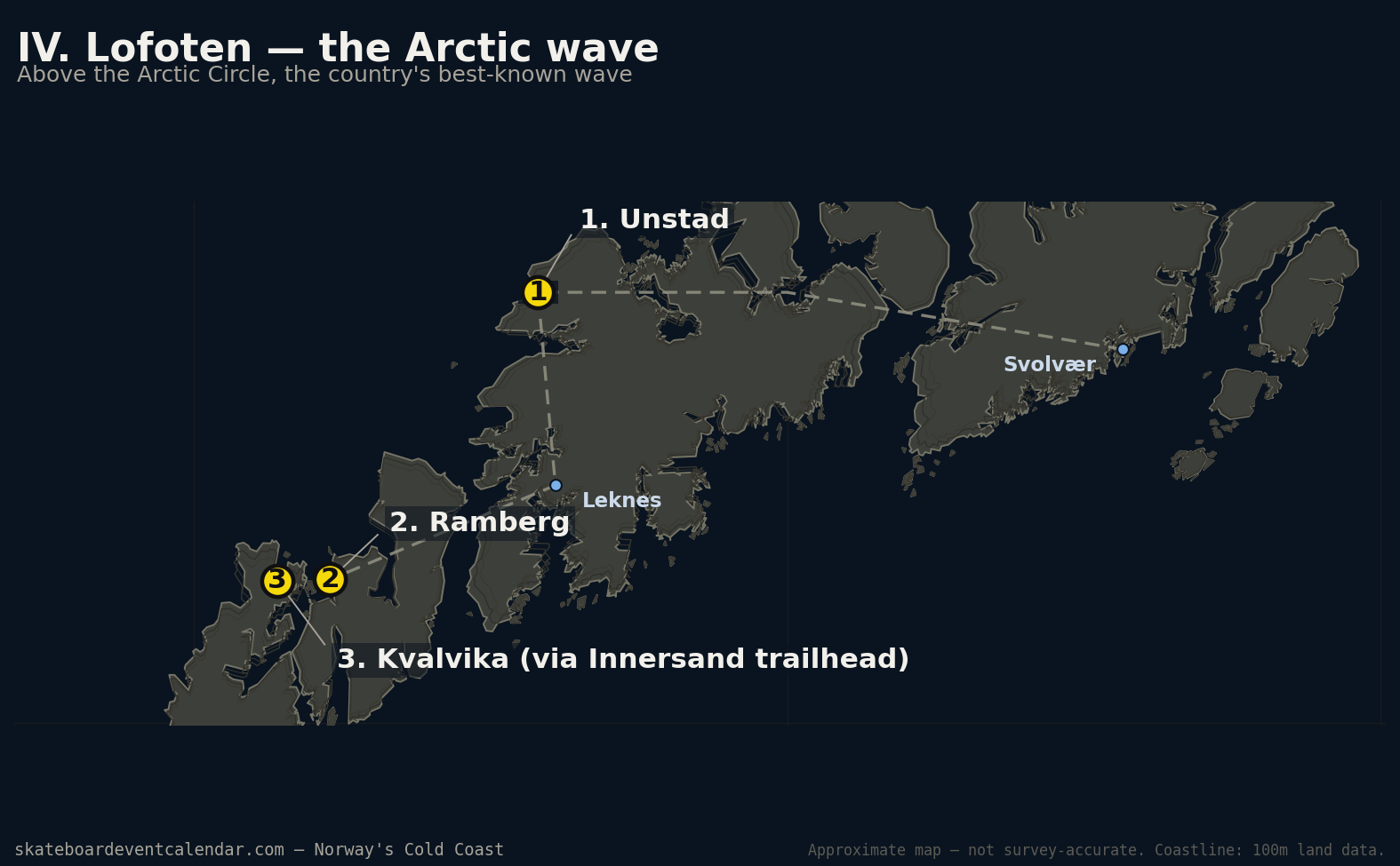
Unstad — 68.27, 13.58 (confirmed). A point break in a horseshoe bay open to the northwest, picking up both west and north swells, with different parts of the bay working depending on which one's running. Offshore in an east wind. There's a surf school and rental setup right on the beach, so despite the remoteness it's approachable for a first Arctic session.
Ramberg — 68.0899, 13.2299 (confirmed). A gentler, wide beach break on Flakstadøya, reachable straight off the E10 highway. Less powerful than Unstad, and a good first-session or short-stop spot. Skagsanden and Flakstadsanden, two similar sand beaches, sit within a few hundred metres of Ramberg along the same bay — same character, no independently sourced coordinate of their own, so they're not pinned separately here.
Kvalvika — 68.0891, 13.1405 (approx — pin marks the Innersand trailhead, not the beach itself). Two beaches inside Lofotodden National Park, on the west coast of Moskenesøya, taking the full open Atlantic swell. Reachable only on foot (roughly 1.5 hours from the trailhead) or by boat — no lifeguards, no facilities, no phone signal to speak of. For experienced, self-sufficient surfers only.
V. Bonus: Vesterålen & beyond
North of Lofoten, the documentation thins out fast. Multiple sources describe Vesterålen, Senja and Troms in general terms as holding "hidden" surf potential, without naming specific breaks or giving coordinates — this is the same kind of gap the Sweden/Denmark map had for eastern Öland, and we're leaving it exactly that visible rather than inventing a pin to fill it. One spot broke through with an actual name attached:
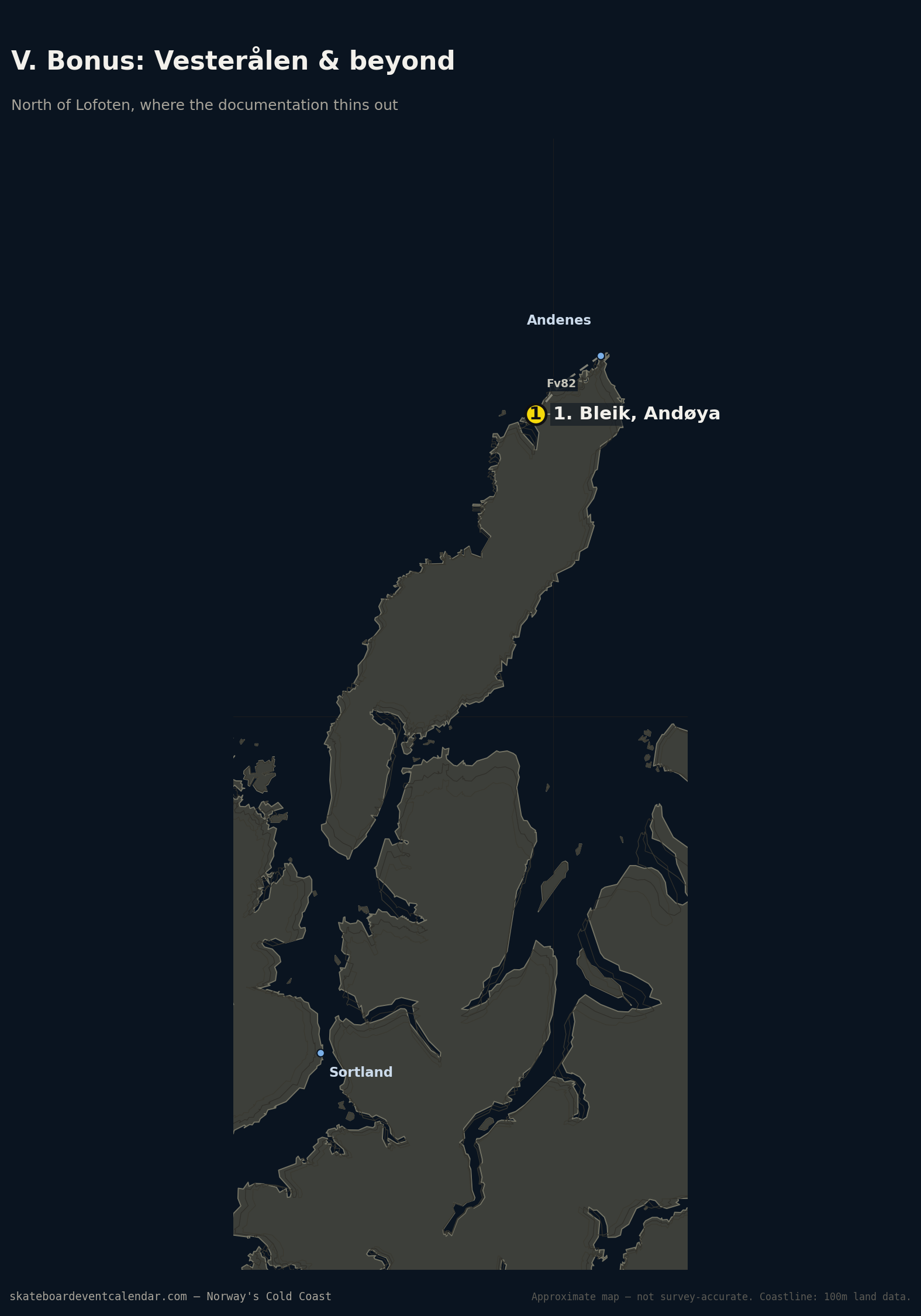
Bleik, Andøya — 69.2726, 15.9554 (confirmed location; not independently confirmed as a working wave surf spot beyond being named in a regional surf round-up). A long, dramatic beach on Vesterålen's outer coast, north of the Arctic Circle and further north than Unstad. Worth a mention as the northernmost point on this map — but treat it as a lead to check locally, not a verified break the way Unstad or Hoddevik are.
Beyond Bleik — Senja, Tromsø, and all of Finnmark up to the Russian border — we found nothing specific enough to put a pin on. If you surf up there, that's the gap in this map most worth filling.
A note on the coordinates
As with the Sweden/Denmark map, every coordinate here is either confirmed — cross-checked against Wikipedia/Wikidata infobox data, surf-forecast.com, or a similar independent source — or explicitly marked approx, meaning the pin marks the nearest reliably-sourced reference point (usually a trailhead or village centre) rather than the exact break. Where we found a named place but no usable coordinate or independent confirmation it's actually surfed — Skagsanden and Flakstadsanden in Lofoten, the broader Senja/Troms/Finnmark region — we said so in the text instead of guessing a pin. The maps use 100m-resolution coastline data rather than a coarser dataset, specifically because Norway's coast is fragmented enough (fjords, skerries, narrow peninsulas) that a lower-resolution land outline drops real headlands and bays entirely — the same issue we ran into and fixed on the Sweden map's Torö Stenstrand pin.
Sources
- Surf Atlas — Surfing in Norway, Surfing in Lofoten, Hoddevik Surf Guide
- Surf-Forecast.com — Reve Havn, Bore, Lista (Bausje), Hoddevik, Unstad
- Visit Sola — Surfing along the coast of Jæren
- Stad Surfing and Ervik Surfshop
- WannaSurf — Ervik, Nordfjord.no — Surfing
- Wikipedia — Hoddevika, Refvika, Ervik, Vestland, Ramberg, Flakstad, Bleik
- iles-lofoten.com — Les meilleurs spots de surf aux Iles Lofoten
- Hike Bike Travel — Ryten Hike & Kvalvika Beach (Innersand trailhead coordinate)
- Best Arctic — Top summer spots for surfing in Northern Norway