
Cold Water Lines: A Surfer's Map of Sweden and Denmark
Long before there were skateparks, there were surf breaks — chasing a wave that might not show up for months is the same hunt as chasing a contest swell. We mapped every named surf spot we could verify along the Swedish coast and the Danish west coast, from a Kattegat harbour wall to Denmark's legendary Cold Hawaii, with sources for every one.
Este artigo está disponível apenas em inglês por enquanto.
There's no Jeffreys Bay here, no Mundaka. What there is, is wind. Scandinavia sits on the wrong side of the Atlantic for the long-period groundswell that shapes Europe's famous coasts — instead the entire story is one of locally generated windswell: a low-pressure system dragging in over the Kattegat, a storm ripping across the North Sea toward the reefs of Jutland, or a single windy afternoon whipping up the Baltic outside a pier in southern Sweden. That's why so many of the spots below only "work" a couple of dozen days a year, and why the most dedicated will drive hundreds of kilometres to stand alone in a bay no guidebook mentions.
If any of this sounds familiar, it should. Chasing a wave that might not show up for months is the same discipline as chasing a contest swell, a dry ledge, or a skatepark that isn't crowded on a Tuesday. Board sports run on the same currency everywhere: patience, weather-watching, and a willingness to drive a long way for something that might not happen.
This is an attempt to map it — name by name, source by source, with coordinates where they exist and an honest flag where they don't. Denmark, with its Cold Hawaii region, has the most developed surf culture in the Nordics and therefore the most precisely named sub-spots. Sweden is more scattered, more of a scavenger hunt — but maybe more interesting reading for it.
Live conditions
Open full screenA live forecast widget for the Swedish west coast (SMHI + Open-Meteo Marine data), covering several of the spots above — including Apelviken, Ringenäs, Tylösand, Skäret and Mölle.
Forecast by KustVåg, an independent project — not affiliated with any spot's local surf club.
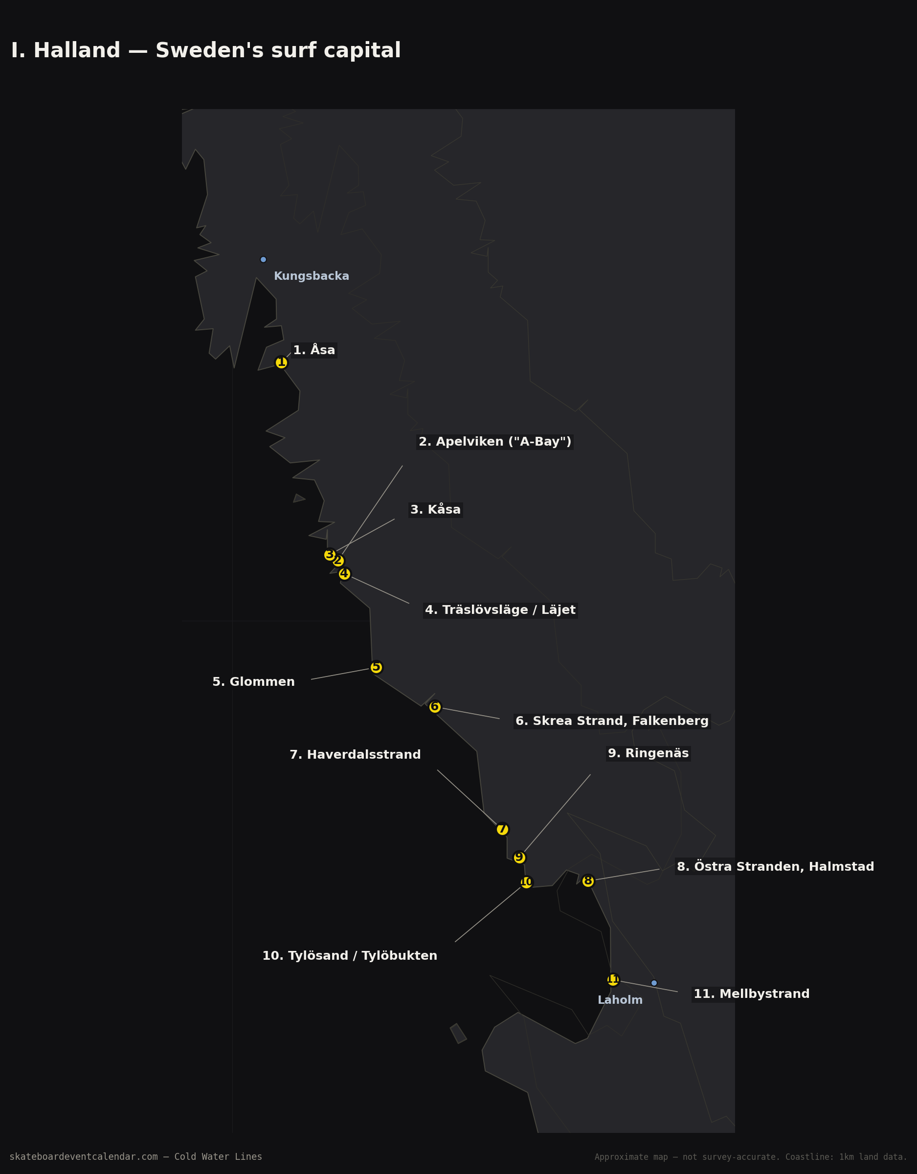
I. Halland — Sweden's surf capital
The southwest Kattegat coast between Gothenburg and Malmö is, by a wide margin, Sweden's most developed surf stretch: sand-bottomed beach breaks, a couple of points, and a beach-town culture that's grown up around the waves over decades.
Apelviken ("A-Bay") — 57.0810, 12.2616. Sweden's best-known surf bay and something like the country's informal surf capital, a horseshoe-shaped bay just south of Varberg where kiters, windsurfers and surfers share the same brackish water. Sand bottom, left and right depending on swell direction, and about 200 metres straight out from the Surfers Center sits an underwater rock that locals know well — a real fin-eater at the wrong tide. Best on southwest-to-northwest swell with a northwest offshore wind.
Kåsa — 57.0892, 12.2415. Varberg's shortboard spot, distinct from the town's mellower longboard waves. A steeper wedge that gets semi-hollow when the windswell picks up — the one of Varberg's three main spots every source singles out as "the fast one."
Träslövsläge / Läjet — 57.0637, 12.2777 (approx). A large, shallow bay just south of Varberg. Builds quickly once the wind picks up, shared with kiters.
Åsa — 57.3486, 12.1220. A right-hander over sand mixed with rock, sheltered by a large jetty — which also makes it rideable in conditions that would be unmanageable on a fully open beach.
Glommen — 56.9372, 12.3564 (approx). A proper Halland point rather than a pure beach break, more streamlined wave shape when the swell lines up against the headland.
Mellbystrand — 56.5159, 12.9427 (approx). A long sand beach in Laholm Bay, works on west-to-northwest swell.
Skrea Strand, Falkenberg — 56.8842, 12.5015 (approx). A popular swimming and kite beach that occasionally delivers surfable waves in the right west wind.
Östra Stranden, Halmstad — 56.6491, 12.8814 (approx, local knowledge). The east-side beach at the mouth of the Nissan river in central Halmstad. A pure beach break — works entirely at the mercy of wind and swell direction on the day, no reef or point to shape it.
Tylösand / Tylöbukten — 56.6473, 12.7287 (approx, local knowledge). Halmstad's best-known beach resort, just south of the city — long open sand, another wind-and-swell-dependent beach break rather than a fixed setup.
Ringenäs — 56.6806, 12.7110 (approx, local knowledge). The headland forming the northern end of Tylöbukten. Same beach-break character as its neighbours — surfable when wind and swell line up, flat when they don't.
Haverdalsstrand / Haverdalsbukten — 56.7188, 12.6687 (approx, local knowledge). North of Halmstad, a further stretch of open beach break with the same wind-dependent nature as the rest of this part of the coast.
II. Skåne — reefs, harbours and Österlen
Where Halland is open Kattegat coast, Skåne is more layered: the Öresund side sheltered by Danish Zealand, the rocky headland of Kullaberg, and Österlen's sandy, east-facing Baltic shore. It's also the region where local knowledge contributed the most to this map.
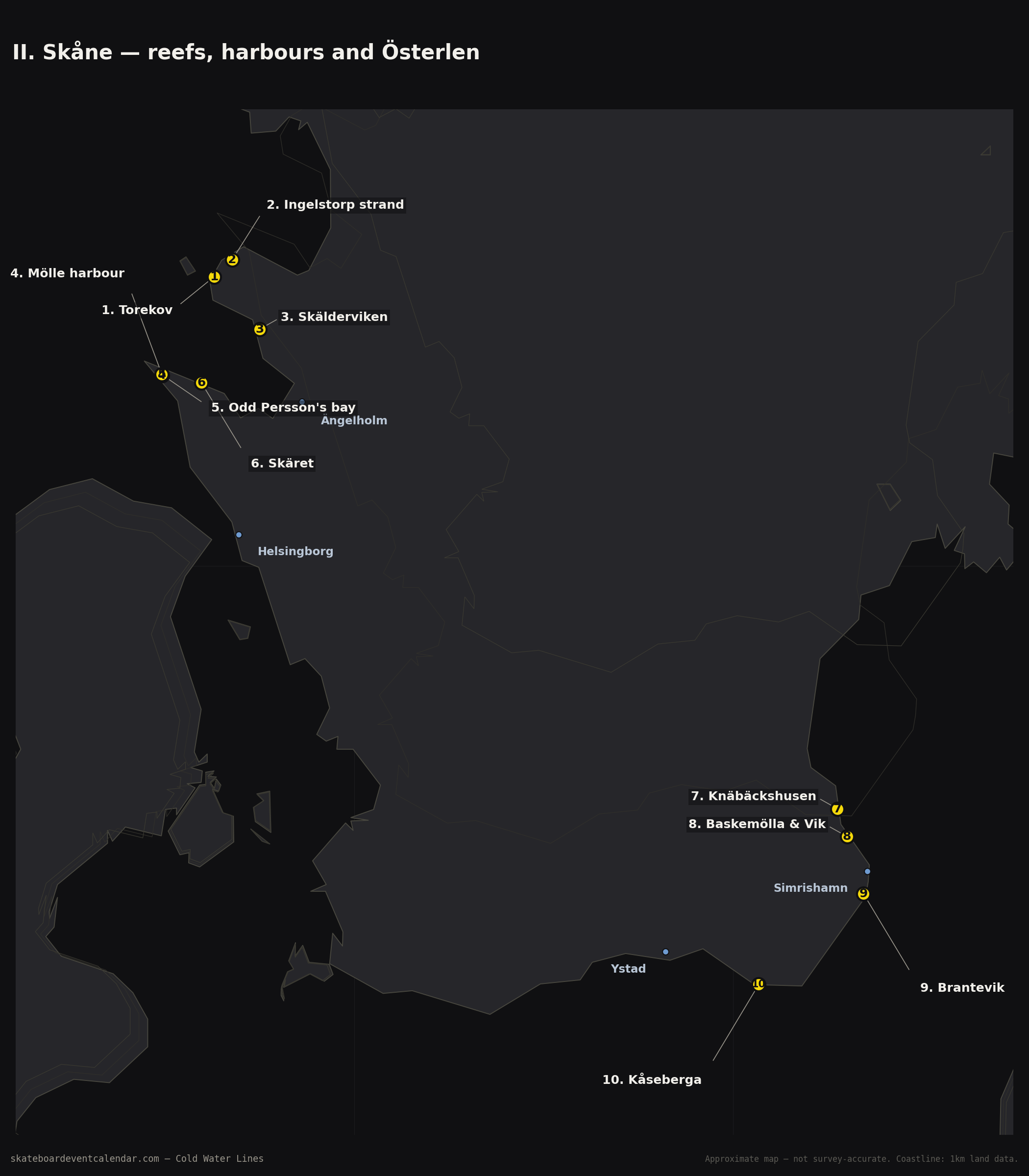
Mölle harbour — 56.2821, 12.4933. At the tip of the Kullaberg headland, where windswell off the Kattegat bends around the point into rocky bays. The main spot is the harbour itself: jump straight off the wall and find a powerful right over a rock reef. Best with a west-to-northwest wind, otherwise mostly mush.
Odd Persson's bay — 56.2831, 12.4920 (approx). Mölle's sister spot, five minutes' walk away — same rock-reef bottom, but its own direction: best northwest to north.
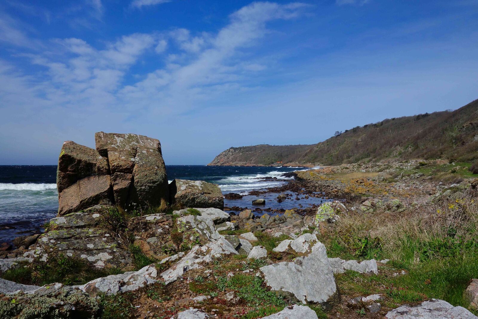
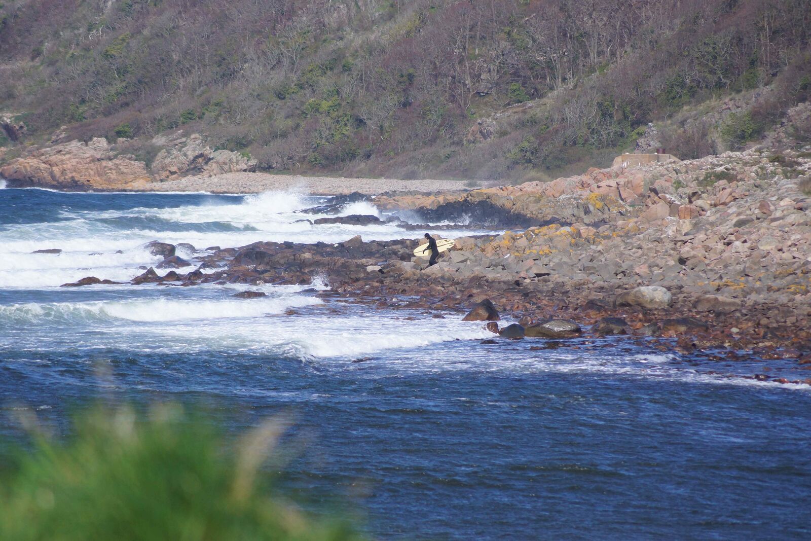
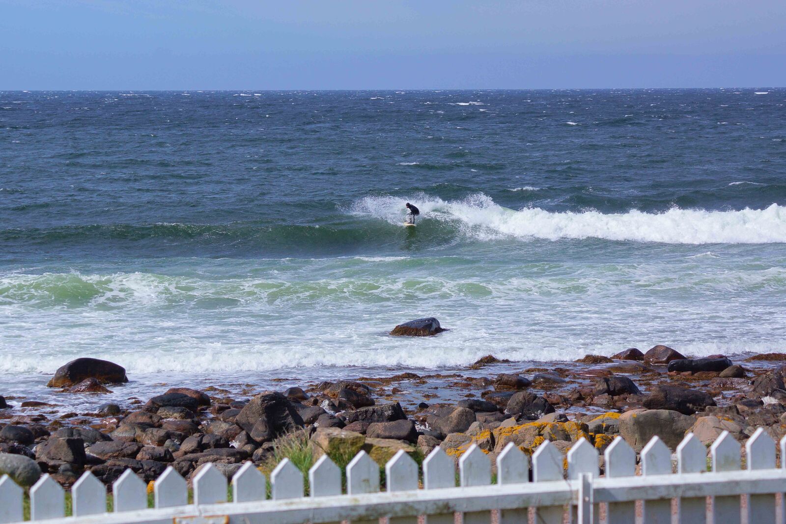
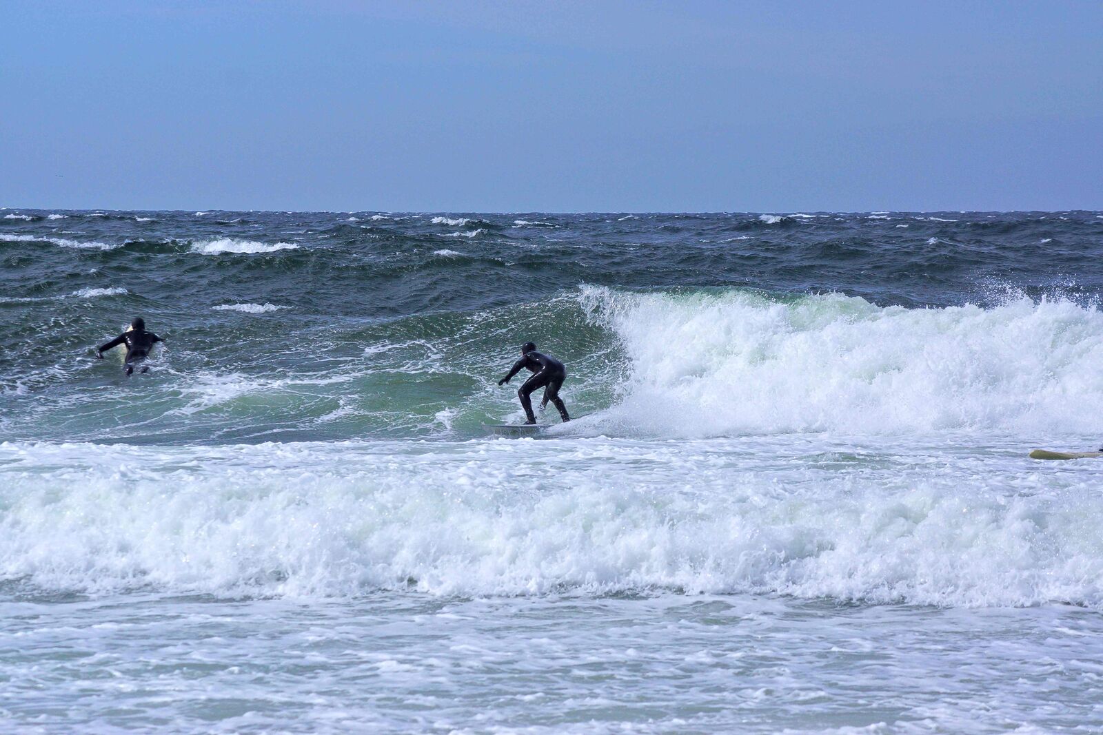
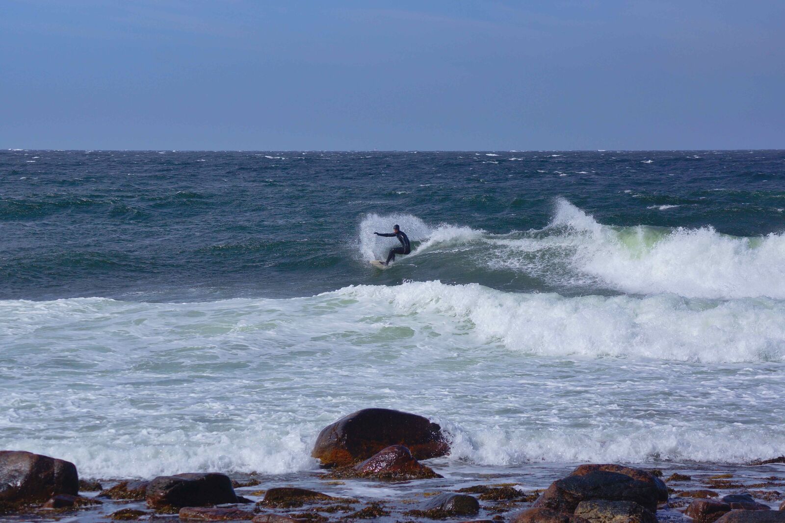
Skäret — 56.271077, 12.596555 (community-confirmed). A left-hand reef a German windsurf journalist once described as potentially world-famous "had it been located somewhere with regular swell" — a stone shelf sloping evenly into the sea with a couple of boulders lurking just under the surface. Best on a west wind. The exact location was long hard to pin down; the coordinate above comes from local knowledge shared during research for this piece.
Kåseberga — 55.3810, 14.0670. Sits right next to Ale's Stones — Skåne's Bronze Age stone ship setting on the headland above the village — which is the landmark local knowledge usually points to when describing the spot. The wave breaks right over sand at the harbour wall: fat and low-power in shape, unusually beginner-friendly for a harbour break. No localism reported, and a fish shop for something warm afterward.
Brantevik — 55.5153, 14.3436 (Wikipedia-confirmed). A right point over sand mixed with rock on Österlen, best accessed from shore when the wind sits south-southeast to east-northeast.
Baskemölla harbour & Vik — 55.6000, 14.3000 (Wikipedia-confirmed, no dedicated surf source). A picturesque fishing hamlet on Österlen, just north of Simrishamn, with a coastal path north to the next hamlet, Vik. None of the surf-specific sources we found mention conditions here directly — these two are in the map on local knowledge alone, geographically plausible but unverified as their own named breaks.
Knäbäckshusen — 55.6410, 14.2748 (confirmed). A long sand beach with a shallow shelf that pushes in knee-high waves most of the winter, and the occasional longboard day in summer. Rarely powerful, but the shape holds up if you bring enough volume. Known for its thatched-roof cottages along the shore, near Stenshuvud north of Simrishamn.
Torekov & Skälderviken — 56.4278, 12.6303 / 56.3500, 12.7500. The northern end of Skälderviken, toward Torekov, has a rockier coast and is used more by wing- and wave-windsurfers than dedicated surfers — though sources describe it explicitly as "surfable" in the right southwest-to-northwest wind. The sheltered southern part of the bay is essentially beginner windsurf water rather than a wave surf spot.
Ingelstorp strand — 56.4530, 12.6781 (local knowledge). A beach inside Bjärekustens naturreservat on the northwest tip of the Bjäre peninsula, by the small harbour at Norrebro, between Torekov and Hovs Hallar. Sand bottom, though recent visitors note it's increasingly weed-covered. Best on a west-to-northwest wind and swell. Not listed in any surf-specific database we checked — in on local knowledge alone, geographically plausible but unverified as a named break, same footing as Baskemölla & Vik above.
III. Stockholm archipelago
East of the capital, the archipelago opens onto the Baltic — and it's here, rather than the west coast, that the country's most surfed spot in absolute terms is located.
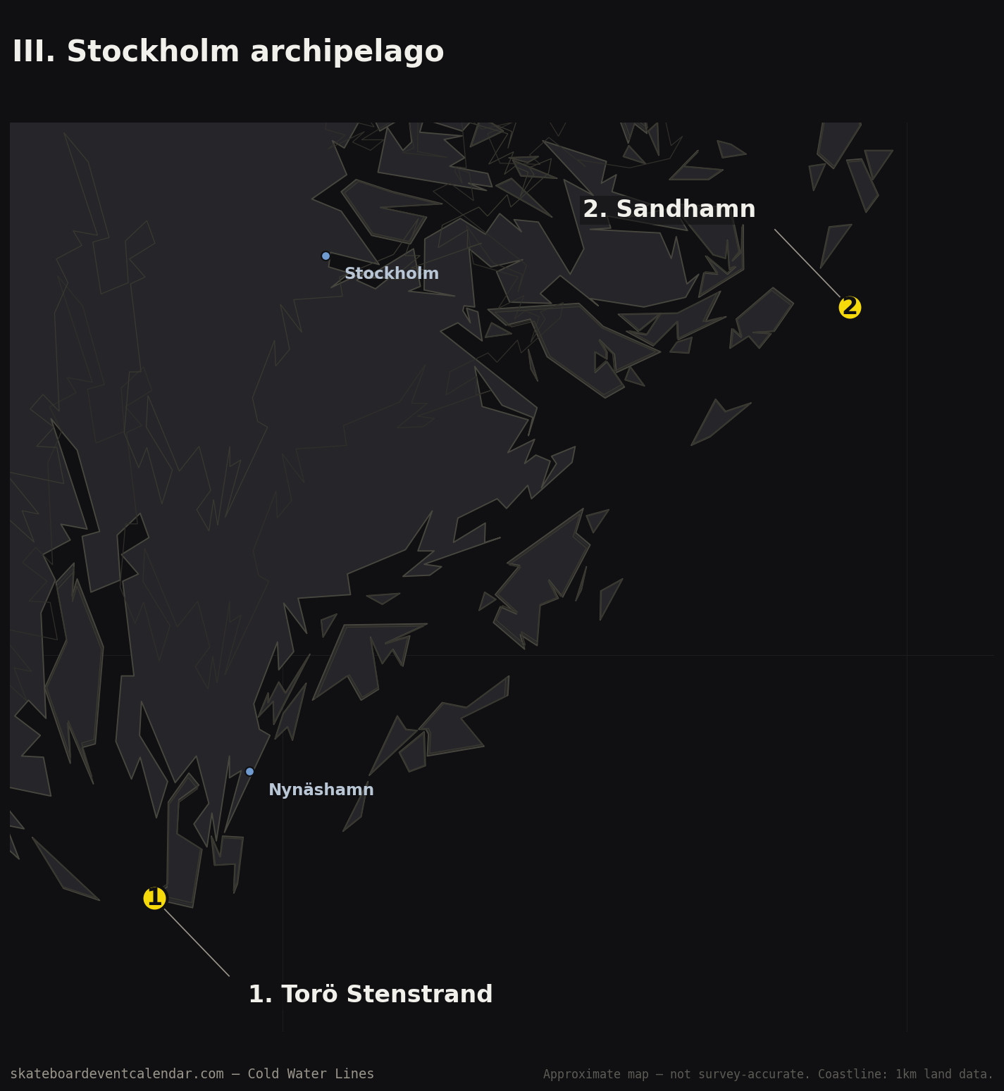
Torö Stenstrand — 58.7997, 17.7944 (confirmed). A good hour from central Stockholm, a long pebble/gravel beach facing due south into the open Baltic. Now Sweden's most surfed spot by most accounts — it used to be a secret, it isn't anymore. Winter storms with an east or south wind produce decent A-frames along the whole beachfront. The west side of the bay is the most exposed; on the east end, left-handers break off the rocks — a completely different wave character from the open sand beach.
Sandhamn — 59.2868, 18.9091 (approx). Sources themselves call it "a roll of the dice" — a spot that only wakes up when the biggest low-pressure systems roll through, but can deliver when they do.
IV. Gotland, Fårö & Öland
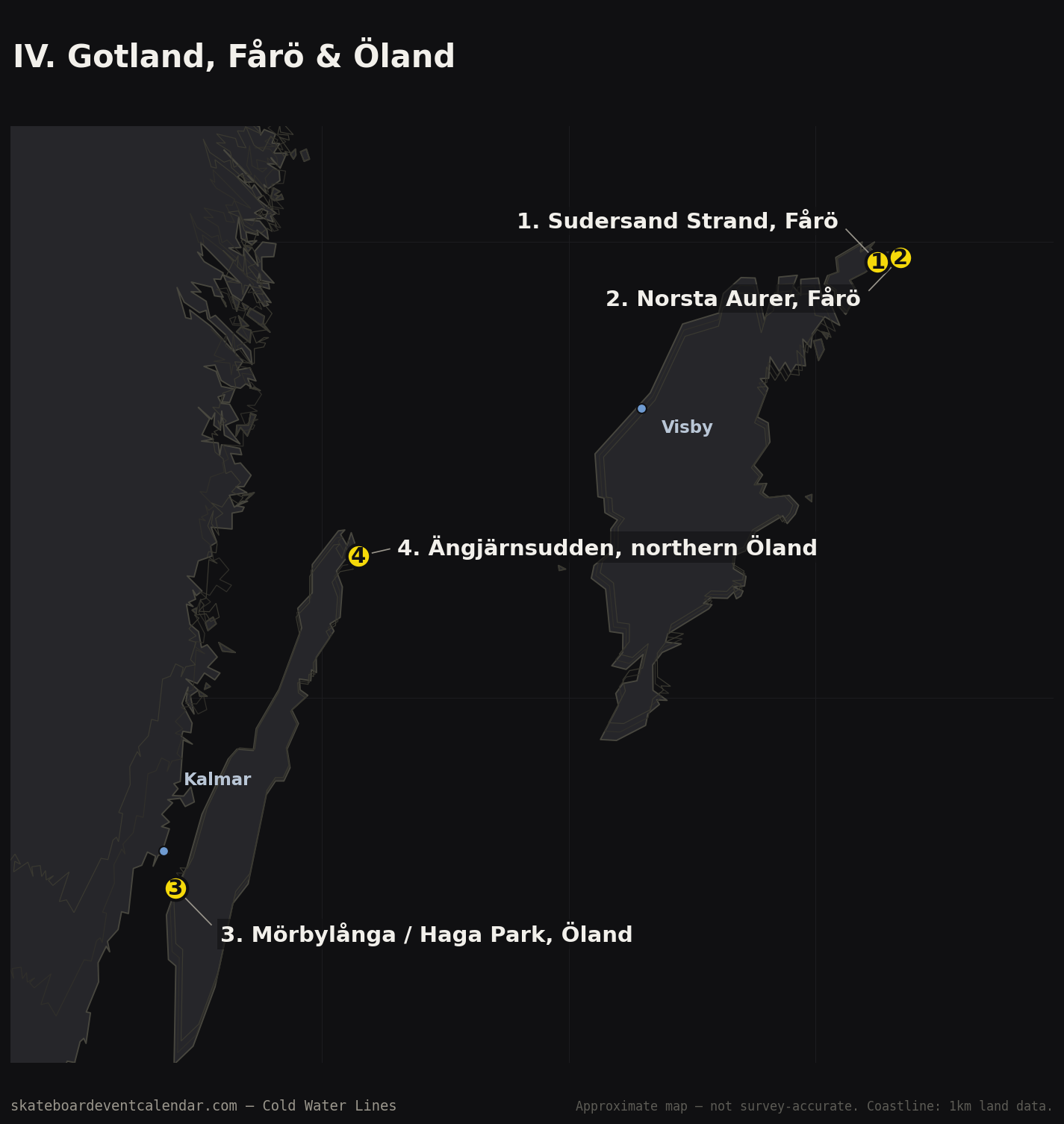
The islands in the middle of the Baltic require a three-hour ferry crossing — and once there, the coastline is largely untouched by surf culture, aside from a handful of named beaches.
Sudersand Strand, Fårö — 57.9560, 19.2515 (approx). A long white sand beach on the island's more exposed east side.
Norsta Aurer, Fårö — 57.9656, 19.3446 (approx). Decent sandbars and, according to sources, often completely empty.
Surflogiet area — location not published, eastern Gotland. A small glamping-based surf outfit aimed at beginners and longboarders, in a sheltered, shallow bay. The exact location isn't given in the source we found.
Mörbylånga / Haga Park, Öland — 56.5814, 16.4067. The only documented "surfing hotspot" we found on Öland — but honestly, it's a wind- and kitesurf spot rather than a wave surf spot: flat water in the Kalmar Strait, known for a reliable sea breeze around 1pm.
Ängjärnsudden, northern Öland — 57.3103, 17.1458 (confirmed). This is the gap above, at least partly filled: an exposed beach and point break right at Öland's northeastern tip, where Bödabukten ends. It faces the open Baltic directly and picks up swell from south through east — the exposure our earlier map was missing. Best with a west (offshore) wind; autumn and spring are the reliable seasons, summer is mostly flat. It's remote — the last stretch in is a rough gravel road out to the point.
V. High Coast & Bohuslän
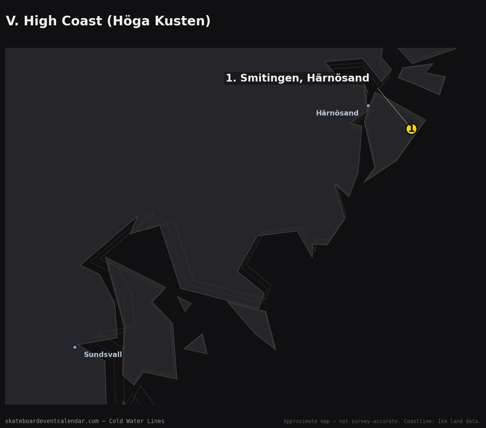
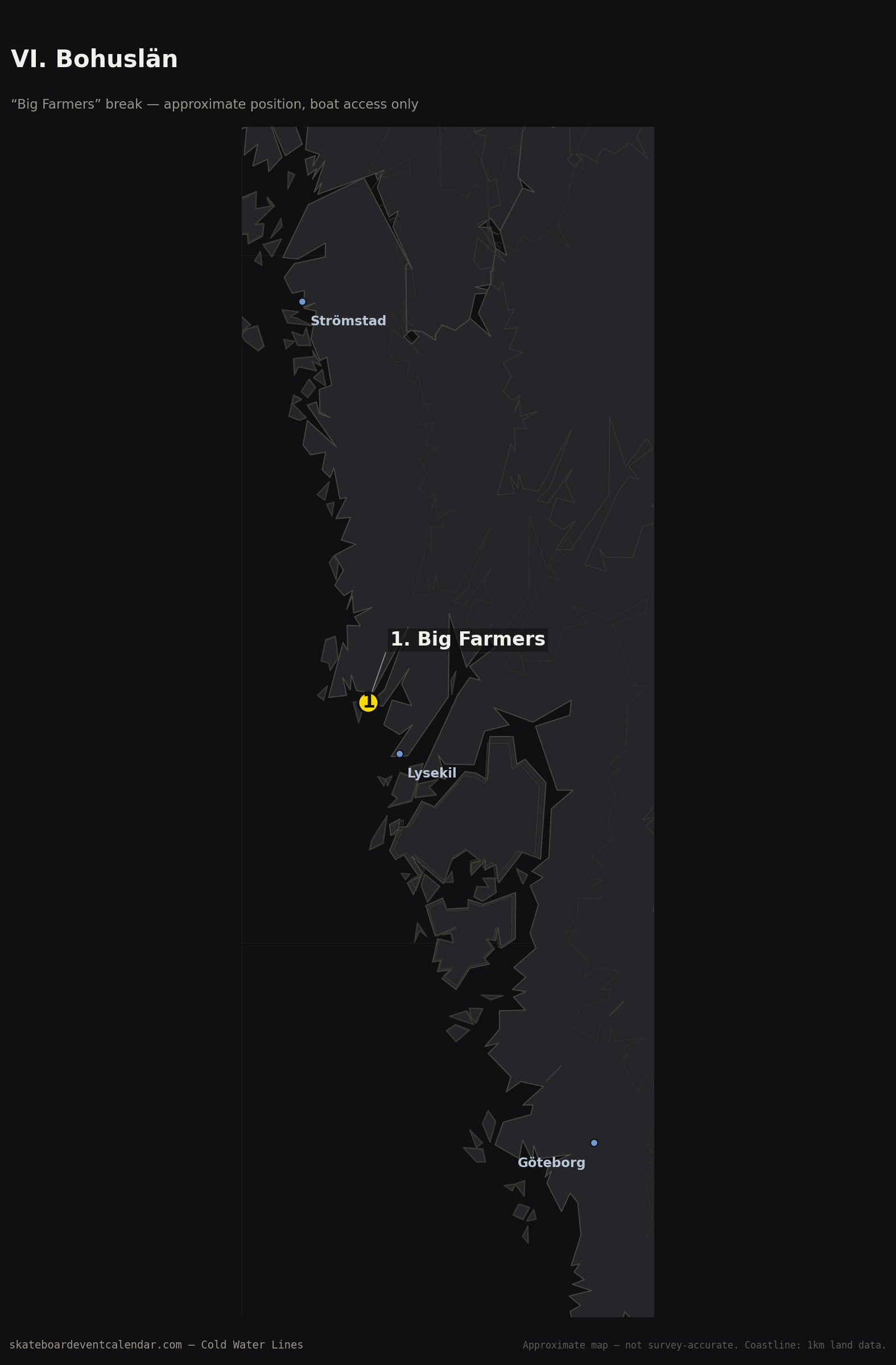
Two opposites: Bohuslän's sheltered archipelago in the south, where the one documented spot requires a boat to reach, and the High Coast in the north, far beyond where most people would guess Swedish surf territory ends.
Smitingen, Härnösand — 62.6074, 18.0314 (approx). The northernmost documented Swedish spot we found — near the Vårdkasberg viewpoint, a sand-bottom beach break that works best with south-to-southeast swell and a south wind. Easy access, under five minutes from a swimming beach, and per the source, rarely if ever crowded.
Big Farmers break — 58.35, 11.35 (highly uncertain). Northern Bohuslän's only documented spot, and it says something that it's boat-access only. A powerful boulder reef, breaking left and right, that reportedly never freezes over in winter. The source explicitly warns of heavy oil tanker traffic nearby — a strong hint at a location near Brofjorden/Lysekil, one of Sweden's few deep-water terminals for supertankers, but this is a contextual guess, not a confirmed location.
Three more names surfaced in a spot database without any town attached: Salusand, Wef, and Å-land. Wef is only described as "Baltic Sea"; Å-land risks being confused with the (Finnish) Åland Islands entirely. They stay on the record as a reminder of how much of the Swedish coast is, as one source put it, "explored but kept secret."
VI. North Jutland — north of Cold Hawaii
Before you reach Thy's legendary stretch of coast, you pass Skagen, Vendsyssel's open beaches, and Hirtshals — where an unusual local curiosity is waiting.
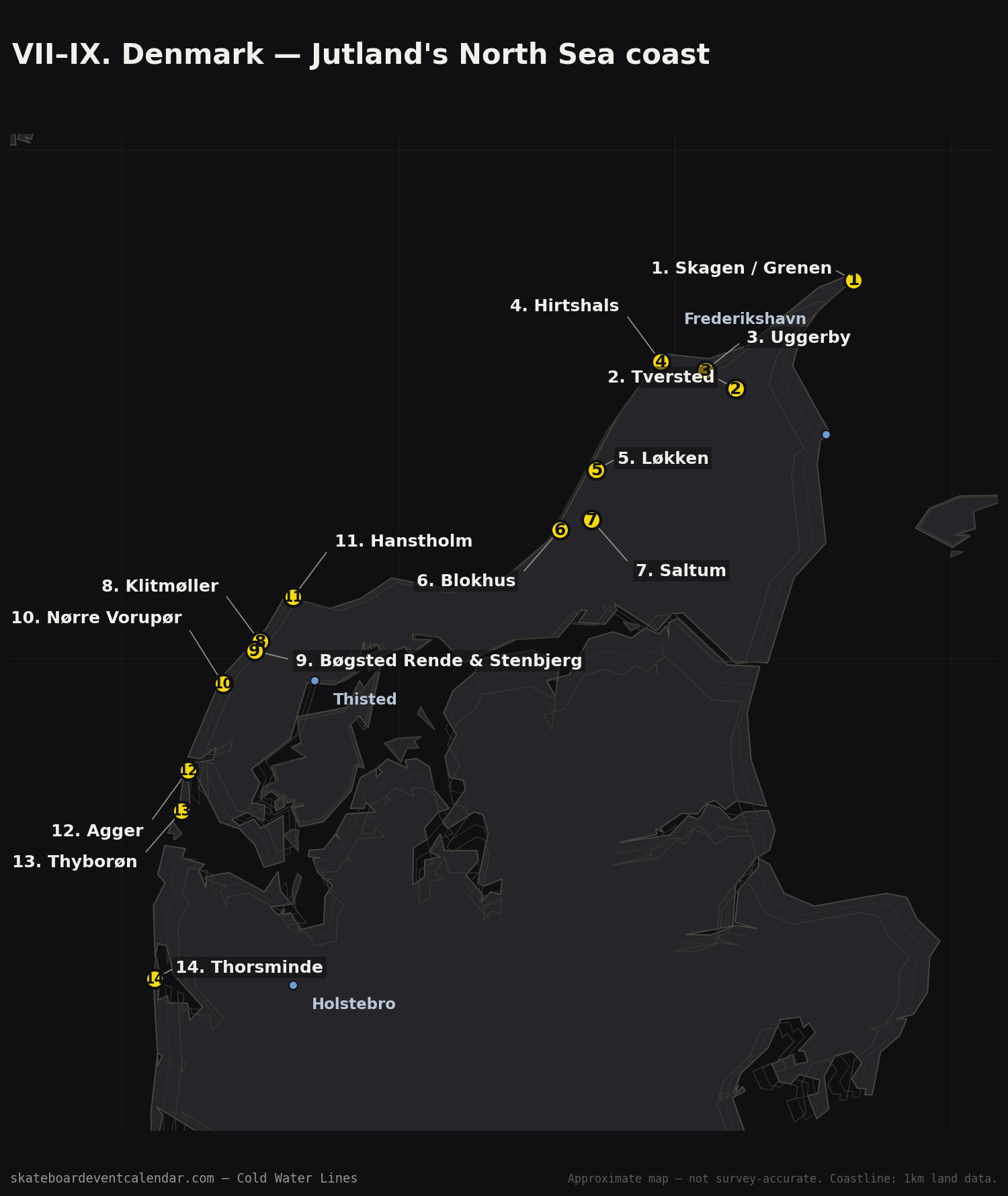
Skagen / Grenen — 57.7436, 10.6453 (approx). Denmark's northern tip, where the Skagerrak meets the Kattegat in visibly crossing currents. Exposed, with genuinely dangerous currents to respect.
Tversted & Uggerby — 57.5300, 10.2200 / 57.5659, 10.1110. Open, less developed beaches — described by local tourism sources as more about solitude and open nature than established surf infrastructure.
Hirtshals — three named sections — 57.5830, 9.9500. Husmoderstranden is the named main beach. The harbour area gives waves off the mole. But the real curiosity is the "ferry wave" — waves generated by the movement of ferries inside the harbour basin, a phenomenon the local tourism board itself calls "more of a curiosity than a classic spot." One of the only entries in this whole map where the wave comes from a ship, not the weather.
Løkken — 57.3706, 9.7167. More holiday resort than surf spot in summer, but in a strong south-southwest to west-southwest wind a breakwater absorbs the smaller waves, so only the bigger ones break over the outer sandbanks. You launch north of the wall — a specific, named way to dodge the steep "Danish" shorebreak that otherwise makes the paddle-out miserable.
Blokhus & Saltum — 57.2522, 9.5842 / 57.2719, 9.6997. Wide, family-friendly sand beaches a few kilometres apart along the same stretch of Jammerbugten.
VII. Cold Hawaii — Thy, Hanstholm to Agger
The name was coined in the 1990s by windsurfing legend Josh Stone, and the stretch between Hanstholm and Agger is today Northern Europe's most developed surf destination — roughly 30 registered spots along one continuous coastline. It's also the only place in this whole map where we consistently found official, named sub-spots within a single town.
Klitmøller — four named sections — 57.0330, 8.5000. Cold Hawaii's epicentre. Tolderstien, Point Perfect (kid-friendly, smaller wave) and Revet (more challenging) all sit within the same bay; Bunkers, named for the WWII bunkers on the dunes above it, is a rock reef a little further along. Four genuinely different waves within a few hundred metres of each other.
Nørre Vorupør — 56.9500, 8.3670. Two piers, two waves: Lille Mole ("Little Pier") on the inside, home to a surf school and a beginner-friendly left; Store Mole ("Big Pier") on the more challenging side. South of town there's a third, separately named section. About 300 metres north of the pier sits Deadmans — per local sources, probably the most powerful, hollowest wave in Denmark.
Hanstholm — four named sections — 57.1200, 8.6200. Middles, Fiskemelen (the name likely comes from the fishmeal factory in the harbour), Fakir and Fisherman's — four sections along a coastline oriented differently from Klitmøller and Vorupør, producing long lefts and room for SUP.
Bøgsted Rende & Stenbjerg — 57.0100–57.0200, 8.4600–8.5000. Inside Thy National Park, wilder and more natural than the better-known spots — conditions here are "a bit wilder, bigger and less staged," per the local tourism board.
Agger — two named sections — 56.7800, 8.2400. Cold Hawaii's southern classic: The Black Houses as a landmark, and a separately named break at a long pier. Strong currents and heavy dependence on sandbank shape make Agger a spot for the experienced rather than beginners.
VIII. The west coast, further south
South of Cold Hawaii the named spots thin out, but two towns stand out for their dual character — ocean on one side, sheltered fjord water on the other.
Thyborøn — 56.7000, 8.2167. The channel between the North Sea and Nissum Fjord creates a beginner-friendly section in addition to the open A-frame beach on the west side — a town where sea, fjord and canal each offer an option within walking distance.
Thorsminde — 56.3700, 8.1200. The same dual logic as Thyborøn: rougher west-coast conditions facing the North Sea, calmer and safer water on the Nissum Fjord side for beginners or when the ocean is simply too much.
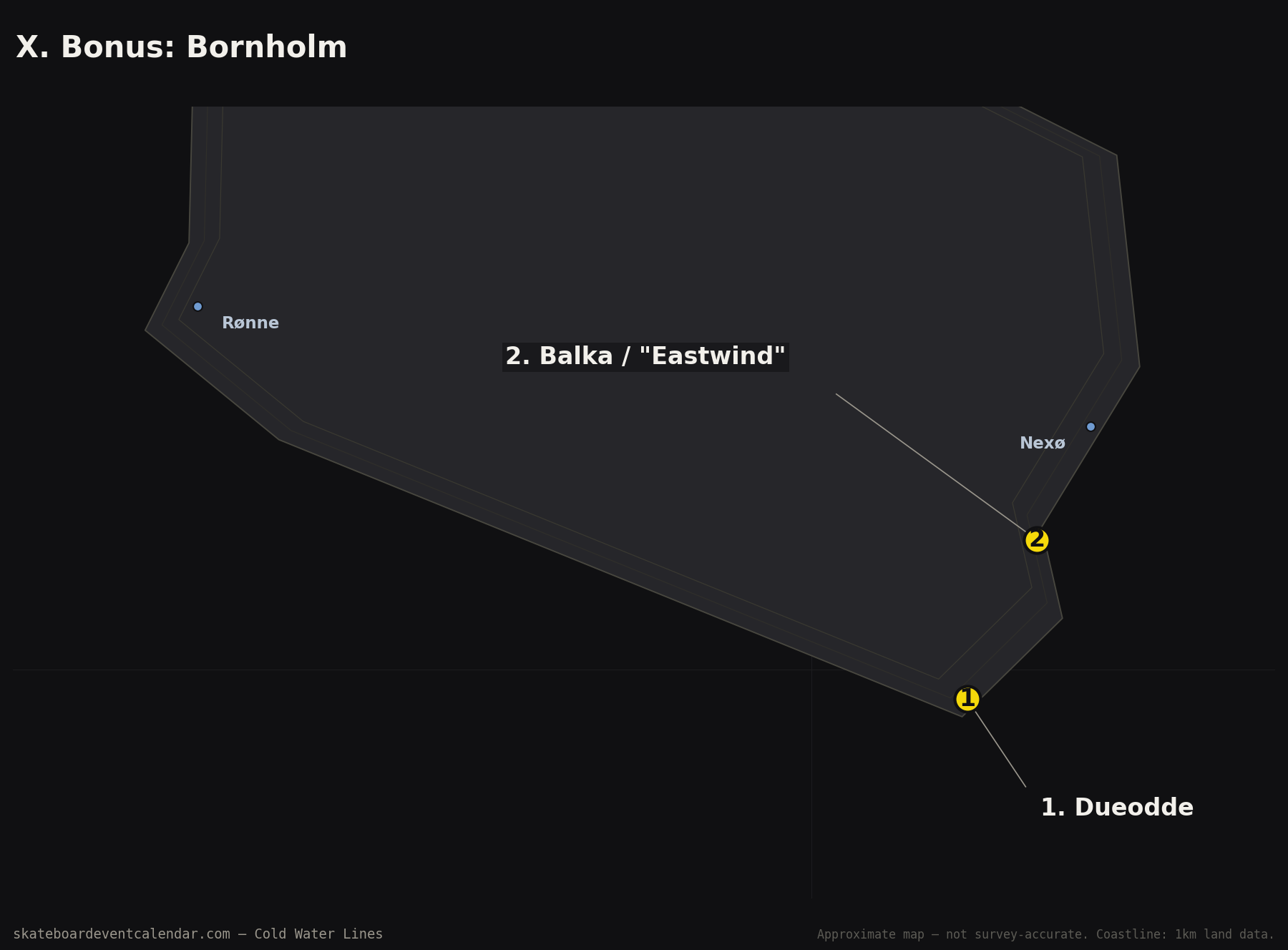
IX. Bonus: Bornholm
Strictly speaking not the Jutland west coast, but an island in the middle of the Baltic between Sweden, Poland and Germany earns its place here — especially since the question came up during research for this piece.
Dueodde — 54.9918, 15.0744. Bornholm's best-known beach, with ultra-fine sand and multiple sandbars. One of the few sources here to explicitly list "surfing" and "body surfing" as activities rather than just wind.
Balka / "Eastwind" — 55.0355, 15.1078. A watersports centre near the old fishing village of Snogebæk — but the waves are consistently described as "typically low, flat," with energetic wind rather than surf in the classic sense.
A note on the coordinates
No Nordic surf-specific database publishes its break locations to more than two decimal places — roughly one kilometre of resolution. Surf-Forecast.com states outright that some spot locations are deliberately offset to protect them. Sandbars in the North Sea and Kattegat also shift season to season, which would make a decimetre-precise coordinate stale within six months regardless.
This map therefore consistently separates three levels of confidence: a source-confirmed coordinate or break name taken directly from a surf-specific source, a town-level approximation based on the named village or beach, and a handful of cases of local knowledge that couldn't be independently verified. No row was invented to pad the list out — where a name had no locatable place (Salusand, Wef, Å-land), that's stated plainly rather than guessed.
Every coordinate above was cross-checked on 2026-09-24 against an independent GPS source for that specific beach or harbour — Naturkartan, Badkartan, allabadplatser.se or badplats.nu for the Swedish spots, Wikipedia/Wikidata for the Danish ones — rather than left as an initial estimate. Several moved by 2–10 km once checked this way (Ringenäs, Haverdalsstrand, Nørre Vorupør and Saltum were the largest corrections); Brantevik and Knäbäckshusen were corrected further on 2026-09-25 after a reader flagged the map pins looked off — both now match their Wikipedia-listed coordinates. Baskemölla harbour & Vik was corrected the same day (moved ~16 km north, to just above Simrishamn) using the same source. Torö Stenstrand was confirmed on 2026-09-25 against a Google Maps coordinate the reader shared (58.7997, 17.7944) — it turned out the coordinate was already correct; what looked wrong was the map's background coastline data, which was too low-resolution to render the Torö peninsula at all (fixed by switching all eight maps to a 1km-resolution coastline dataset, which also sharpened the archipelago detail throughout). A few named spots (Tversted, Bøgsted Rende & Stenbjerg, Agger, Thorsminde, Big Farmers break) still have no independent source to check against and keep their original approximate placement.
Sources
- spots.guru — Best Surf spots in Sweden, Kåseberga, Big Farmers break, Smitingen
- Surf-Forecast.com — Klitmøller, Nr. Voruper, Appelviken, Toro
- Surfnerd — Sweden, Halland County, Klitmøller, Nørre Vorupør, Hanstholm
- BreakFinder — Denmark
- The Surf Atlas — Surfing in Sweden
- Encyclopedia of Surfing — Sweden
- Surf Magazin — Spot Guide Sweden, Skäret feature, Spot Guide Southern Sweden, Cold Hawaii, Klitmøller
- VisitNordvestkysten — Surf spots at the Northwest Coast, Klitmøller & Vorupør
- Naturkartan — Surfing in Halland County
- South Baltic Tourist — sbt.ug.edu.pl (Öland, Bornholm, Malmö)
- Kite & Windsurfing Guide — Løkken
- Local knowledge: Skäret's exact coordinate, Baskemölla harbour, the identification of the Kåseberga/Ale's Stones area, and the Halmstad-area beach breaks (Östra Stranden, Tylösand/Tylöbukten, Ringenäs, Haverdalsstrand) were contributed directly by a reader during research for this piece.